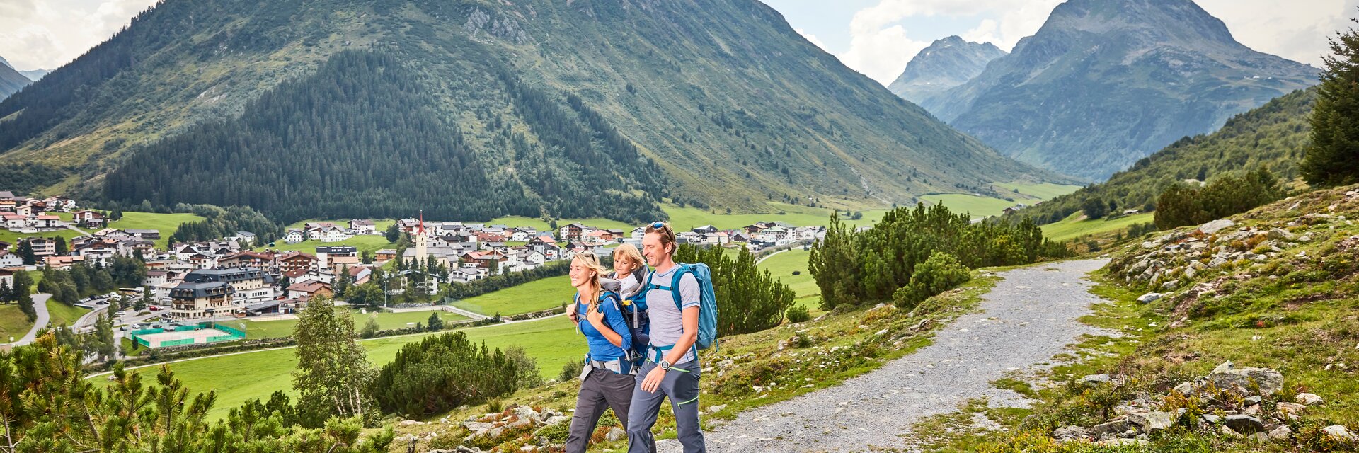
You’re a mountain lover and experienced hiker? You love challenging tours, steep, rocky terrain and exposed sections? Or are you rather looking for a relaxed stroll together with your children on secured paths? No matter what you’re looking for – Ischgl has the perfect hiking tour for every taste and skill level:
► Easy hiking trails are relatively easy hiking - & mountain trails that can be narrow and steep. There are no direct passages at risk of falling.
► Moderate hiking trails are mostly narrow, often steep and can have passages at risk of falling. In addition, short insured walking passages (e.g., wire rope) can occur.
► Difficult hiking trails are narrow, often steep and have passages at risk of falling. There are parts of assured walking passages and/or simple climbing spots that require the use of the
hands. Surefootedness and head for heights are essential.
Stay calm in an emergency and notify Mountain Rescue (Alpine emergency signal: 140)
Alpine emergency signal: at regular intervals, six times in one minute make a visual or acoustic signal – then pause for 1 minute –repeat, until you get a reply.
In the event that it is not possible to raise the alarm for help from the accident site: A messenger should make the descent to fetch assistance – but the injured party should never be left alone! If possible do not make the descent alone.
The messenger should have the following written details: Precise location of the accident, type of injury, Number of injured parties and uninjured parties in the group, they should also leave any clothing, rain gear and food they do not require for the injured party to use.
There’s no holiday for you without your dog? The Paznaun offers perfect conditions for a hiking holiday with your four-legged friend!
Name | Difficulty | Map | ||
---|---|---|---|---|
Galtuer-Tour 01: Menta-Alm - Scheibenalm | E | |||
GPX Download
KML Download
Starting from the village square you start the hike toward the Jamtal valley. First a little steep and later flat you will reach the Menta Alm at the beginning of the valley. Here, even at the start of the entrance to the valley, you get a unique view to the Jamtal glacier. The Menta Alm and the Scheibenalm are two places where you can enjoy a nice stop-off for refreshments, and take a breather for a while. There is also the chance to try out Paznaun specialities here. At the end of June/start of July in particular the blossoming alpine roses provide another impressive backdrop for your hike. |
||||
Galtuer-Tour 02: Zeinisjoch | E | |||
Galtuer-Tour 03: Sonnenkogel | E | |||
GPX Download
KML Download
Starting from the village square in Galtür, go past the soccer field to reach the shore path. Cross the bridge and walk until you reach the sign, which leads to the Sonnenkogel. From here the hike continues on narrow meadow paths up to the Sonnenkogel, which promises a wonderful view to the south into Jamtal - whit its Jamtal glacier, along with the Hinteren (3.156 m) and Vorderen Jamspitze (3.178 m). In the south west giant impressive mountains above Galtür come into view, such as Ballunspitze (2.671 m), Valülla (2.813 m) and Gorfenspitze (2.558m). |
||||
Galtuer-Tour 04: Waldweg zur Larein Alpe | E | |||
GPX Download
KML Download
The district of Tschaffein is reached via the shore path or the opposite Maasweg path. At Haus Trisanna you will cross the bridge, the hike then continues pleasantly along the road to the Stafali fork in the road. Stafali Pond is wonderfully located in the middle of the forest and its cosy barbecue areas invite you to stay and relax for a while. From there the turn-off for Lareintal can be reached in around ½ hour, this way leads you in the end to Lareinalm. Lareinalm, a really nice cosy place to stop-off, also provides you with the chance to sample and purchase tasty treats from the Paznaun region, such as milk, cheese and butter. |
||||
Galtuer-Tour 05: Panorama Talweg | E | |||
GPX Download
KML Download
Starting from the village square in Galtür, walk towards the soccer ground until you reach the boardwalk. Cross the bridge, turn right and walk until you reach the signpost, which leads to the Sonnenkogel. From here the route leads towards Tschaffein. Cross the street and take a right turn after 500 metres. This forest path holds some spectacular views of Galtür. Be inspired by the beauty of high alpine mountain panorama. Follow the path towards Jamtal until you reach Eggalp and then turn right towards Galtür. After 100 metres turn left and after approx. 20 minutes you reach Winkl. After passing the Alpinarium you reach the starting point - village square Galtür - again. Along this route, you find signs with useful information about flora and fauna. |
||||
Galtuer-Tour 06: Alpkogelbahn - Kopsstausee - Zeinisjoch - Galtür | E | |||
GPX Download
KML Download
A chairlift takes you to Alpkogelbahn mountain station to around 2.000 metres altitude. The route proceeds gently inclined past Breitspitzbahn until you finally reach the trail along the banks of the Kops reservoir. Having arrived here you have a choice - either hike left across the reservoir wall to the kiosk at Kops reservoir, or proceed right along the trail along the bank direct to Alpengasthof Zeinisjoch. The Zeinisjoch mountain pass is not just a border area between Tyrol and Vorarlberg, the Rhine-Donau watershed also runs here. |
||||
Galtuer-Tour 07: Zeinisjoch - Wiegensee | E | |||
GPX Download
KML Download
By car or bus you are able to get to the Alpengasthof Zeinisjoch. The route then climbs slightly uphill toward Heilbronner Hütte. After Verbella Alpe follow the mountain trail on the left until you reach your destination, the deep blue Wiegensee, which invites you to enjoy a leisurely stop-off with its rest areas and wide footbridge. |
||||
Galtuer-Tour 08: Rundwanderung Vergiel | M | |||
GPX Download
KML Download
Starting from the village square in Galtür follow the signposts for the sports and cultural centre. This route proceeds past Haus Predigberg, along the edge of the forest toward Predigberg through the forest named after it, Predigbergwald. Here you take a left turn at the fork in the road and finally reach Bödale. This is also a popular starting point for paragliders and provides a wonderful view to the east into the valley to Kappl. |
||||
Galtuer-Tour 09: Jamtalhuette | M | |||
GPX Download
KML Download
From the village square in Galtür follow the hiking trail past the hotel Hotel Rössle, cross the bridge, then head right into Jamtal. Along the way you go past the Menta Alm and Scheibenalm, which are both managed. Then follow the way up until you reach the Jamtalhütte. From the lodge there is a superb view to the Jamtal glacier which is a cosy place to stop-off for refreshments and where you are invited to have a break. |
||||
Galtuer-Tour 10: Sonnenkogel - Friedrichshafener Hütte | M | |||
GPX Download
KML Download
You reach the Sonnenkogel, as described in tour G.3, where you have a spectacular view to the local mountains of Galtür, Gorfenspitze and Ballunspitze and into the Jamtal. Follow the sign „1.000 Höhenmeterweg - Friedrichshafener Hütte“, which leads you through the avalanche protection to the road heading to the Friedrichshafener Hütte. |
||||
Galtuer-Tour 11: Versailspitze | M | |||
GPX Download
KML Download
By car or bus you are able to get to the Alpengasthof Zeinisjoch. The route climbs slightly from here to Heilbronner Hütte up to Verbella Alpe. Beside this, a path heads up the western slope and from there reaches the shoulder in hairpin bends. The route continues up to a trough to the Jöchli and finally across a wide south-facing ridge to the summit, which promises a superb view to the giant mountains of the Silvretta, Rätikon and Montafon ranges. |
||||
Galtuer-Tour 12: Neue Heilbronner Hütte | M | |||
GPX Download
KML Download
Reach the Alpengasthof Zeinisjoch by car or hiking bus. From here the trail climbs slightly, heading along crystal clear mountain lakes and past Verbella Alpe to Neue Heilbronner Hütte, which can be seen in the distance even on the elevated areas in the middle of the mountain massif, providing wonderful views into Schönverwalltal. |
||||
Galtuer-Tour 13 und 14: Heilbronner Huette - Muttenjoch - Friedrichshafener Huette | M | |||
GPX Download
KML Download
By car or by bus to Alpengasthof Zeinisjoch. From here the route heads slightly uphill past Verbella Alpe and along the crystal clear mountain lakes to Neue Heilbronner Hütte. The route then continues on to Friedrichshafener Hütte, along the crystal clear lakes, into Ochsental, where at the end of this section the short yet steep ascent |
||||
Galtuer-Tour 15: Breitspitze | M | |||
GPX Download
KML Download
You can get to the car park for Kops reservoir by car or by bus. Proceed here across the reservoir wall, then head along a section of the bank trail, then take a right turn toward Breitspitzbahn. Follow a narrow path here initially, then you will reach a well signposted path into flat terrain up to Breitspitze. At the summit an impressive view right into Montafon awaits. |
||||
Galtuer-Tour 16: Faednerspitze | M | |||
GPX Download
KML Download
By car or by bus get to the Zeinisjoch at 1.822 m. From there hike past Alpengasthof Zeinisjoch and follow the signposts for Fädnerspitze. Climb higher on narrow paths – just beneath the summit the path becomes noticeably steeper and somewhat more exposed. At around 2.800 m you reach the summit and panoramic views to the Silvretta group, then head down to Kopsstausee. |
||||
Galtuer-Tour 17: Bielerspitze | M | |||
GPX Download
KML Download
By car or by bus get to the Bielerhöhe at 2.037 m. From Berggasthof Piz Buin proceed to West to the chapel, before the route then takes a sharp right and turns off, heading up to the Bielerkopf, where there is a summit cross. The narrow path continues up to the Bielerspitze at 2.545 m, where you get a fantastic view to Silvretta Stausee, and also to the mighty Piz Buin. |
||||
Galtuer-Tour 18: Rundwanderweg Silvretta-Stausee | M | |||
GPX Download
KML Download
By car or by bus get to the Bielerhöhe at 2.037m. The circular hike along the reservoir dam starts here, passing a waterfall that plunges into Bieltalbach, until you come to the southern banks of the lake. Then follow the western banks back, until you once again come to the Bielerhöhe. Enjoy the impressive mountain panorama, with views to the mighty Piz Buin at 3.312 m. |
||||
Galtuer-Tour 19: Wanderung Piz Buin Blick | M | |||
GPX Download
KML Download
By car or by bus get to the Bielerhöhe at 2.037 m. The route proceeds left here along the reservoir dam until just before the end, at the signpost, a wide hiking trail branches off to the left and proceeds with a moderate incline into Bieltal. Follow the path up to the beginning of the stream and continue via a narrow hiking trail. The ascent then proceeds in hairpin bends to Radsattel (2.652 m), and afterwards heads downhill again until you reach Wiesbadener Hütte. Here an impressive mountain panorama opens up for you: the Piz Buin (3.312 m), Silvrettahorn (3.244 m) and Schneeglocke (3.223 m) are impressive with their breathtaking high rocky cliffs. |
||||
Galtuer-Tour 21: Gorfenspitze | D | |||
GPX Download
KML Download
From the village square in Galtür, the hike proceeds to the Alpinarium and from there to the hamlet of Winkl. From there proceed through a steep forest section up to Gorfenspitze. At around 2.000 m, above the forest, this route and its exposure is really only suitable for experts. Continue to a ridge beneath the summit. From here it is very steep and in parts there are some sections of easy climbing (difficulty level 1) to get to the start of the via ferrata route. The ascent to the summit should only be tackled with full via ferrata equipment (climbing belt, via ferrata set and helmet). |
||||
Silvretta Ferwall Marsch - Family | E | |||
GPX Download
KML Download
Die Silvretta Ferwall Marsch Woche bietet ein abwechslungsreiches Aktivprogramm von 16. - 22.08.2020 mit einheimischen Berg-/Wanderführern und interessanten Geschichten über Galtür in der Blauen Silvretta. |
Name | Difficulty | Map | ||
---|---|---|---|---|
Galtuer-Tour 20: Predigberg | D | |||
GPX Download
KML Download
Starting from the village square in Galtür follow the signs to the sports- & culture centre and then ascent towards the Predigberg through the forest. After 1 ½ hours the landscape changes into a more alpine surrounding and you will reach the „Bödale“ which is a popular spot for paragliders. Here you already have a magnificant view into the valley. After that the trail gets steeper and especially the last part of it requires step security on coarse gravel. |
||||
Ischgl-Tour 01: Idalpe- Paznauner Taja | E | |||
GPX Download
KML Download
Reach Idalp at 2.317 m with the cable car. Follow the descending path past the Alpenhaus and the Vider Alp into the Höllkar. After that there is a small ascent towards Sassgalun following another descent to the lodge Paznauner Taja. The popular lodge offers typical regional products. |
||||
Ischgl-Tour 02: Erlebniswanderweg Ischgl-Idalp | E | |||
GPX Download
KML Download
This exciting tour offers many rest and adventure spots and is ideal for families. The cable car takes you to the Idalp mountain station at 2.317 metres altitude. Follow the signs „Erlebniswanderweg Idalp - Ischgl“, which lead to the „Vider Truja“ adventure park. After that the walk continues to the Fimba / Silvretta middle station, where the new adventure trail „Walk of Lyrics“ begins, which suprises with installations around international music legends. The two suspension bridges, which spectacularly span some 100 metres over the impressive Kitzloch gorge are the highlights. |
||||
Ischgl-Tour 03: Familienwanderung "Adventure Stage" Schwarzwassersee - Pardatscher See | E | |||
GPX Download
KML Download
This hiking trail to the area of „Adventure stage“ is easily accesible and ideal for a exciting day with the family. Take the cable car (Fimba or Silvretta) to reach the middle station and follow the signs leading to the adventure stage. After leaving |
||||
Ischgl-Tour 04: Rundwanderung Idalpe | E | |||
GPX Download
KML Download
Take the Fimbabahn or the Silvrettabahn to the Idalp at 2.317 m. Initially follow the path to the Vellilbahn valley station. Afterwards the circuit proceeds slightly uphill, before then heading downhill in a sweep to Vider Alp. |
||||
Ischgl-Tour 05: Rundwanderung Mathon | E | |||
GPX Download
KML Download
Starting from the church „St. Sebastian” in Mathon follow the main road for around 200 m (toward Ischgl) until you reach the Dreikönigs chapel in Mathon. Cross the road here and follow the signposts for „Rundwanderweg Mathon“. Above Mathon cross the Matnal river and follow a path until you finally cross the Valley hiking trail. |
||||
Ischgl-Tour 06: Madleinsee | M | |||
GPX Download
KML Download
Starting from the Silvretta cable car in Ischgl cross the main road and follow the signposts for Madleinsee. From here follow the hiking trail to Mutta and Kreuzbichl and you will eventually come to Madleinsee where a sheep flock spends the summer. From there head north, you will see the Küchlspitze (3,147 m) which guarantees a wonderful view. |
||||
Ischgl-Tour 07: Rauher Kopf - Variante Aeusseres Bergli | M | |||
GPX Download
KML Download
Rauher Kopf is Ischgl‘s local mountain and is about 3 hours from the village. The route proceeds from the Silvretta cable car to the church and then to the intermediate station. The strenuous ascent proceeds through the forest to the Tschamatschkopf, from where there is still some 300 metres of climbing to tackle. |
||||
Ischgl-Tour 08: Fimba - Heidelberger Huette | M | |||
GPX Download
KML Download
Starting from the Silvretta cable car in Ischgl the hike proceeds to Ischgl church and continues to Hotel Valülla. From there follow the signposts for Fimbatal and the hiking trail to the middle station. The route then heads along Bodenalpe, Gampenalpe, to Heidelberger Hütte. Fimbatal is the biggest lateral valley in Paznaun. Return journey via metered lodge taxi (call +43 (0) 5444 5757 to make arrangements in advance). |
||||
Ischgl-Tour 09: Variante Flimjoch - Heidelberger Huette | M | |||
GPX Download
KML Download
Take the cable car initially to the Idalp at 2.320 m. After that, take the chair lift up to the Flimjoch. The hike then undulates continually, but moderately so, before heading down from the Palinkopf into Fimbatal, where you pass the border for Switzerland before reaching the Alpine inn. |
||||
Ischgl-Tour 10: Schmugglertour Alp Trider Sattel | M | |||
GPX Download
KML Download
The cable car takes you to Idalp mountain station to around 2.320 metres altitude. From there the route heads, as outlined in tour I.9, to the Greitspitze (regular visitors‘ cross) at 2.872 m. After this follow the hiking trail to Salaaser Kopf (2.744 m), Zeblasjoch (2.539 m) to Samnaun. Samnaun was for a long time, up until the end of the 2nd world war, a lucrative destination for smugglers from Paznaun. These days the price differences are quite a bit less than they were 30 years ago (Samnaun is a duty-free zone). The aerial cable car in Samnaun, with its double-decked gondola, providing space for 180 people, is the biggest of its kind in the world. |
||||
Ischgl-Tour 11: Friedrichshafener Huette & Georg-Prasser-Weg | M | |||
GPX Download
KML Download
You can reach the starting point of this tour - the parking lot „Friedrichshafener Hütte“ via car or via the hiking bus (direction Mathon /Galtür), stopping at „Piel“. While ascending take the shortcut and you will reach the Friedrichshafener Hütte at 2.144 metres in about 2 hours (overnight stay possible). Either you walk the same way back or you have the following option as an extended variante. From the lodge follow the sign „Georg Prasser Weg“ and hike up the steep path up to the Schafbicheljoch. After that you reach the highest point, the Vertinespleiskopf at 2.700 metres before you hike down again in direction of the Muttenjoch and later you will reach the Friedrichshafener Weg (dirt road). Here chose the narrow path down to Galtür named „1.000 Höhenmeter Weg“. |
||||
Ischgl-Tour 12: Bergli-Larein | M | |||
GPX Download
KML Download
Starting from the church “St. Sebastian” in Mathon follow the main road for around 150 m toward Galtür until you reach the underpass (Gasthof Glöckner). From there follow the signposts for ‚Bergliweg‘. After a steep climb a wonderful natural experience on Berglisee opens up before you. You can take a rest here and enjoy the tranquillity of the natural surroundings. Its azure color promises a refreshing dip in the middle of Ischgl‘s mountain backdrop. Afterwards the route continues along the treeline to Lareintal. Here an abundance of photo opportunities are on offer – such as the view to the Schnapfenspitze with the impressive Larein glacier. Lareinalm is a managed alpine lodge where you can try typical Paznaun speciality dishes. |
||||
Ischgl-Tour 13: Vergroeßsee | D | |||
GPX Download
KML Download
From the Silvretta cable car in Ischgl, cross the main road and follow the signs towards Vergröß lake to Versahl. This tour continues along a sunny steeply uphill, first through the forest and then on the plateau to the Vergröß lake at 2.539 m, which impresses with a deep blue color and the unique view. |
||||
Ischgl-Tour 14: Buerkelkopf | D | |||
GPX Download
KML Download
Take the Silvrettabahn or the Fimbabahn, then the Flimjochbahn to get to the 2.750 m Flimjoch, where the Austria-Switzerland boundary proceeds. From there follow the route to Bürkelkopf, whose summit cross sits enthroned at 3.032 m. This tour proceeds through high alpine terrain and requires sure-footedness and a head for heights. |
Name | Difficulty | Map | ||
---|---|---|---|---|
Kappl-Tour 01: Kappler Berg - Perpat - Althof - Untermuehl - Kappl | E | |||
GPX Download
KML Download
From the village square in Kappl, go past the bakery and cross the Dias river to then follow the route, which leads you past the little districts of Schmiedsegg, Obermühl, Untermühl to Perpat. From there the way turns right to Althof and Ballestadele , from where the valley hiking trail brings you back to the village. Along this path you also head past the oldest farm in Unterpaznaun with its unique facade paintings and the decorative frescoes. Hiking across the Kappler Berg is always an adventure and while hiking across the quiet meadow paths there is little village upon little village, each has its own special character. There is barely any other place where you can experience Paznaun mountain farming at its most original. |
||||
Kappl-Tour 02: Visnitzweg - Wassserfall - Rotwegkapelle | E | |||
GPX Download
KML Download
Starting from the village square in Kappl, this route proceeds down to the valley station for the cable car. There, cross a wooden bridge to get to Kohlplatz. Follow path no. 17 until you get 30 m before the first junction. The route branches off there to Visnitz Waterfall. Visnitzbach plunges down some 30 m here. Afterwards take the steep path back to the Rotwegkapelle junction and follow the route up to the chapel. From here the hike proceeds downhill via forest road no. 17 to the junction for the hamlet of Wiese, continuing along the edge of the forest to the main road. From here, at the junction for Wiese, head up to Hotel Edelweiss Schlössl and then bear right, through the hamlets of Stiegenwahl - Höfen - Tschatscha and Bild to get to Kappl village. |
||||
Kappl-Tour 03: Rundweg Egg - Oberhaus - Kappl | E | |||
GPX Download
KML Download
Starting from the village square in Kappl take a left at the bakery and hike along the municipal road to the hamlet of Egg. Head for Dias here until you reach a little chapel, which is also a popular place to take a breathe with a superb panorama view. Above the chapel follow the wider path to the crossroads for Dias and Oberhaus. Take a right here onto the forest trail and go via Diasbach to Oberhaus. Follow route no. 9 you will eventually get to the village of Kappl again via meadows and forest. |
||||
Kappl-Tour 04: Diasweg - Heiligkreuz Kapelle - Ruhesteinkapelle | E | |||
GPX Download
KML Download
From the village square in Kappl, the hike leads you to the hamlet of „Ulmich“. After „Höfen“ take the forest trail no. 6 (towards „Dias“) on the right side. After a while you will reach the Heiligkreuz chapel and after that a big forest glade where the Ruhestein chapel is situated, which was built in 1817. This spot is perfect to take a little break and enjoy nature. |
||||
Kappl-Tour 05: Mittagkopf | M | |||
GPX Download
KML Download
Starting from the village square in Kappl the route leads, as outlined in tour K.2, to the the Rotweg chapel. From there follow the signges to Visnitzalm. Above the lodge a forest trail heads left to beneath the Mittagkopf. From here a colourful hiking trail begins, surrounded by lots of alpine roses, up to Mittagkopf, which promises an impressive view into the alpine area. |
||||
Kappl-Tour 06: Panoramaweg | M | |||
GPX Download
KML Download
Starting from the village square in Kappl the route follows, as outlined in tour K.2, to Rotweg chapel. From the chapel continue on the forest road up to the sign for the panorama path. Here you get to a forest road via a marked and in part steep forest trail, which takes you to the branch-off for Grübelesee and Labebene. Continue along trail no. 15, follow the signs for Kappl. This beautifully located footpath takes you down to the high school. Here you continue into the valley until the Kohlplatz bridge, which you cross, and follow the signposts for Kappl. The panorama path stands out mainly for the wonderful view to the sunny side of Kappl and on hot summer days also provides lovely shaded spots in the forest. |
||||
Kappl-Tour 07: Gruebelesee | M | |||
GPX Download
KML Download
As outlined in tour K.2, you reach the junction towards Grübelesee passing by a waterfall and the Rotweg chapel on the panorama path. Continue hiking across the flat forest trail, following the Grübelebach until you reach Grübelesee, whose deep blue hue radiates a feeling of calm. |